GeoMedia GIS Software
Powerful GIS platform improving spatial data management. Aggregate information from multiple sources, analyze dynamically, and share insights with teams.
Visualize, analyze and share geospatial intelligence
From data to decision -- transform your work
GeoMedia transforms geospatial data into actionable insights. Visualize in 2D and 3D, integrate CAD, GIS and database formats, and analyze spatial relationships with dynamic queries and network modeling. Supports real-time updates and OGC standards for interoperability. Drive smarter decisions with flexibility, performance and efficiency for urban planning, infrastructure or enterprise operations.
Key features that power your GIS workflows
GeoMedia delivers comprehensive tools for visualization, analysis, and collaboration. From 2D and 3D mapping to advanced spatial analysis and seamless data sharing, discover how GeoMedia helps organizations unlock the full potential of their geospatial data with precision, speed, and efficiency.
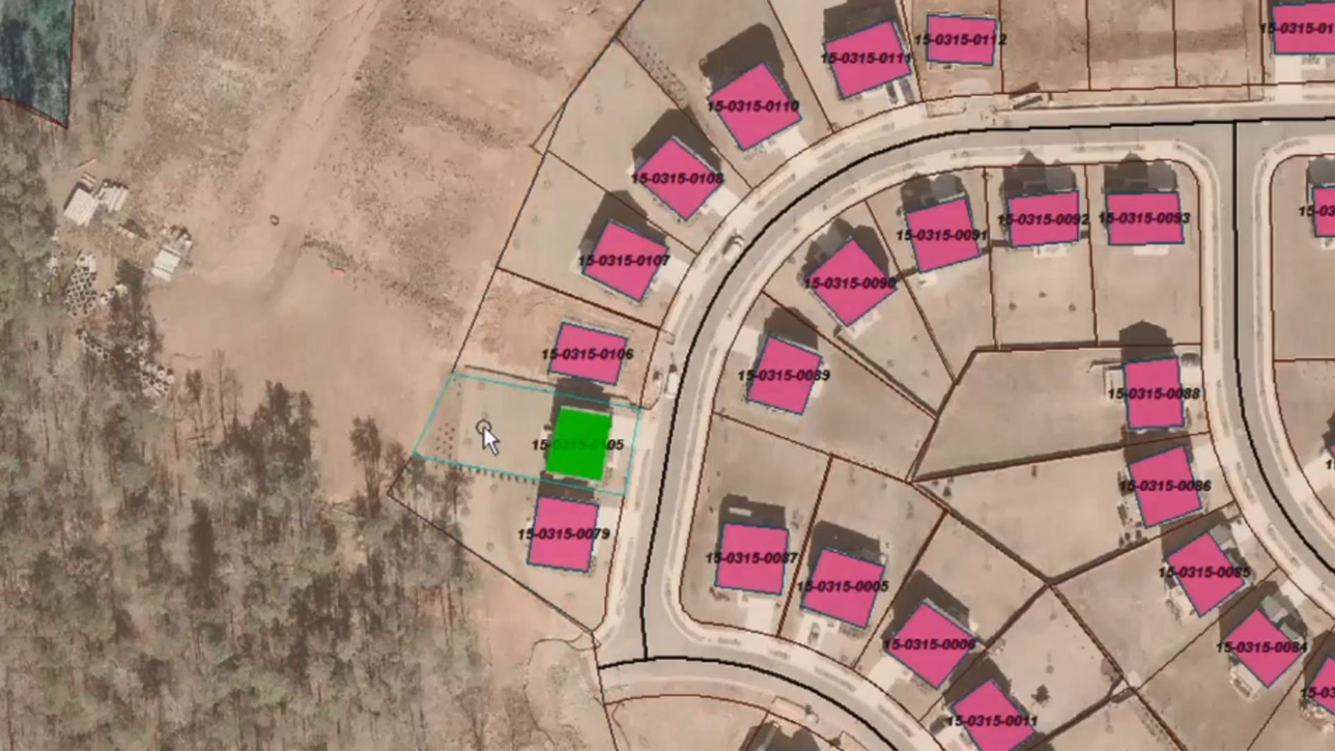
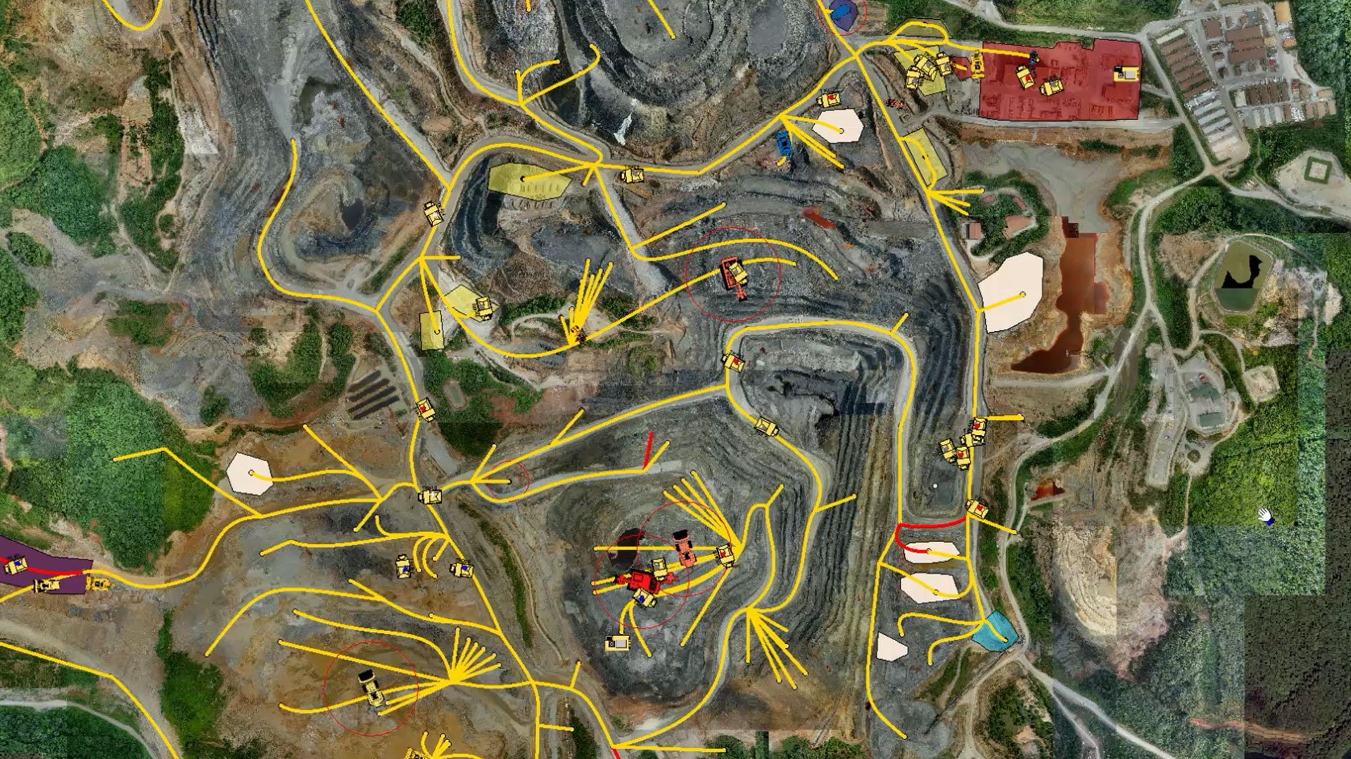
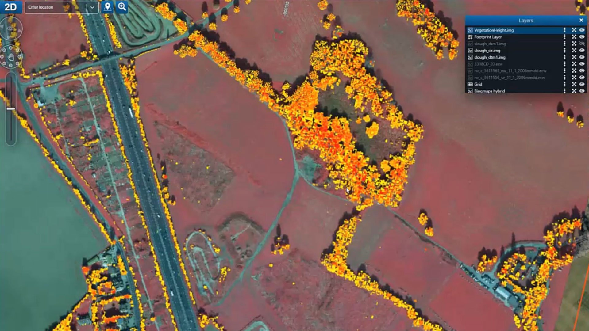
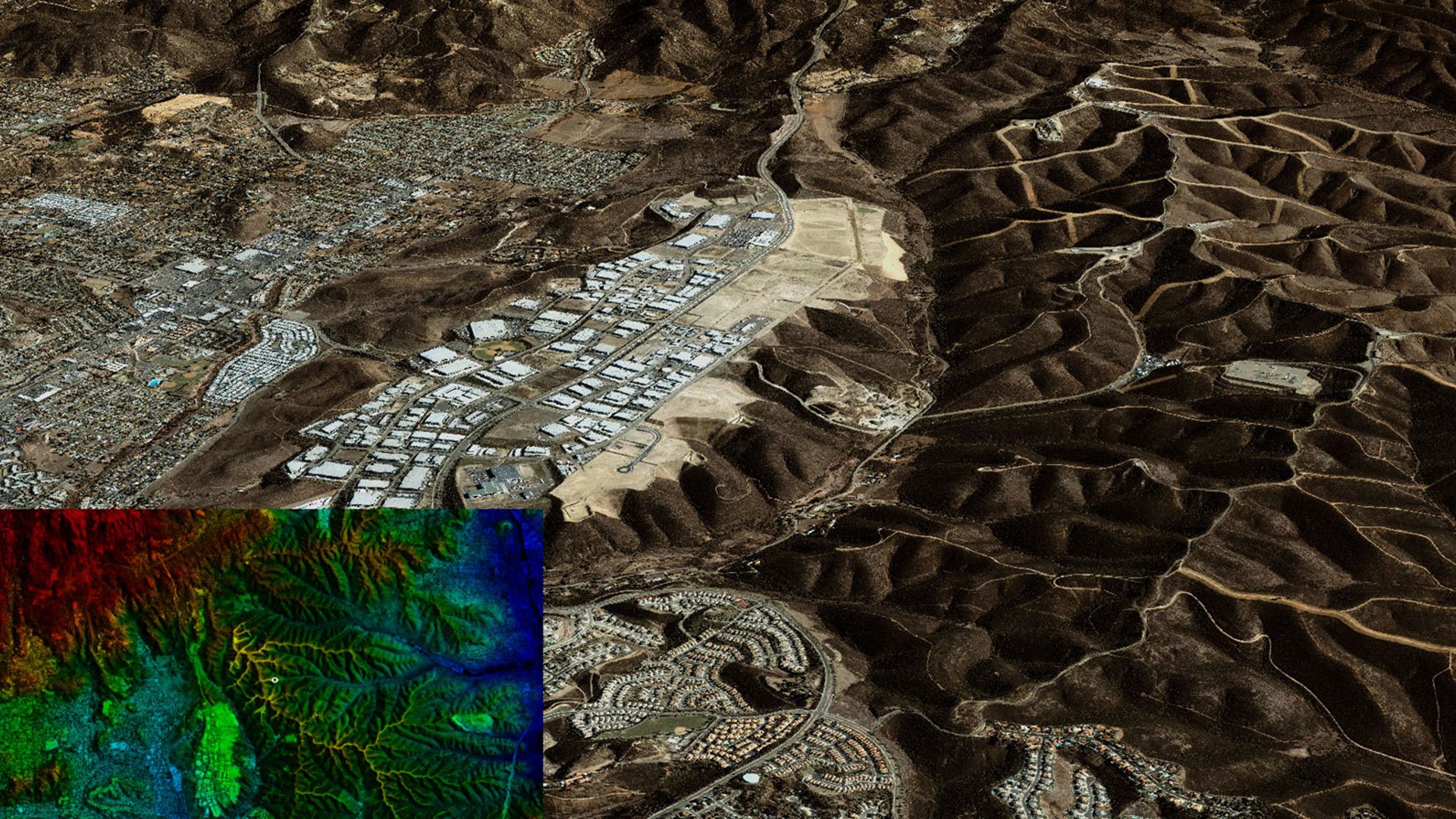
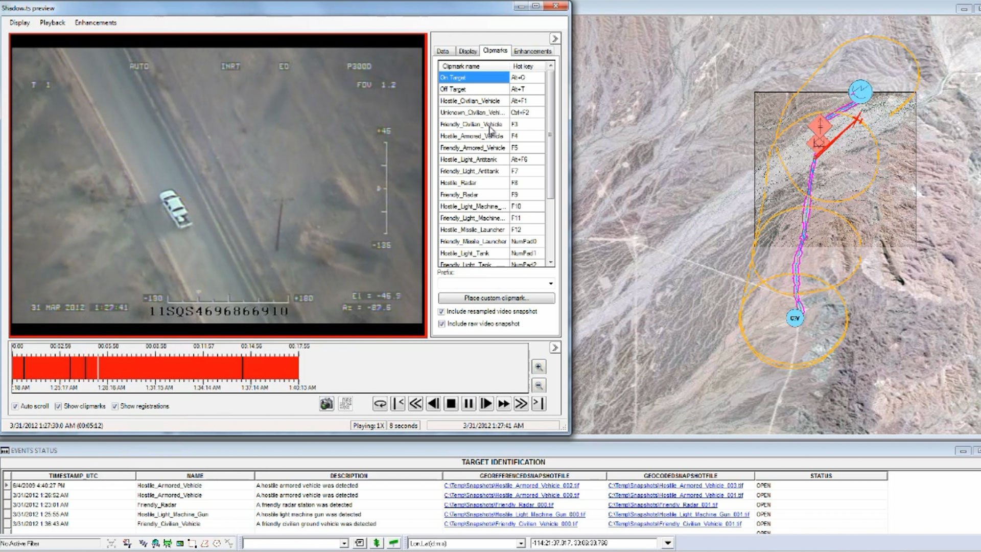
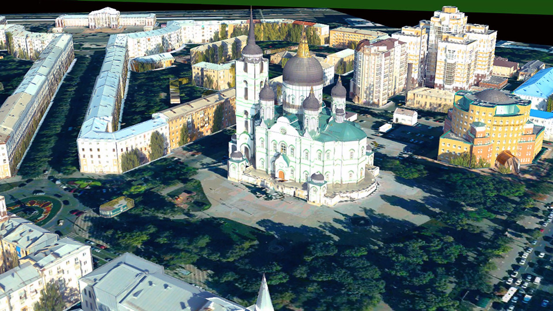
Advanced Visualization in 2D and 3D
Create interactive maps, 3D models, and dynamic reports. Display diverse data formats in one unified view to provide comprehensive spatial insights for better communication and decision-making.
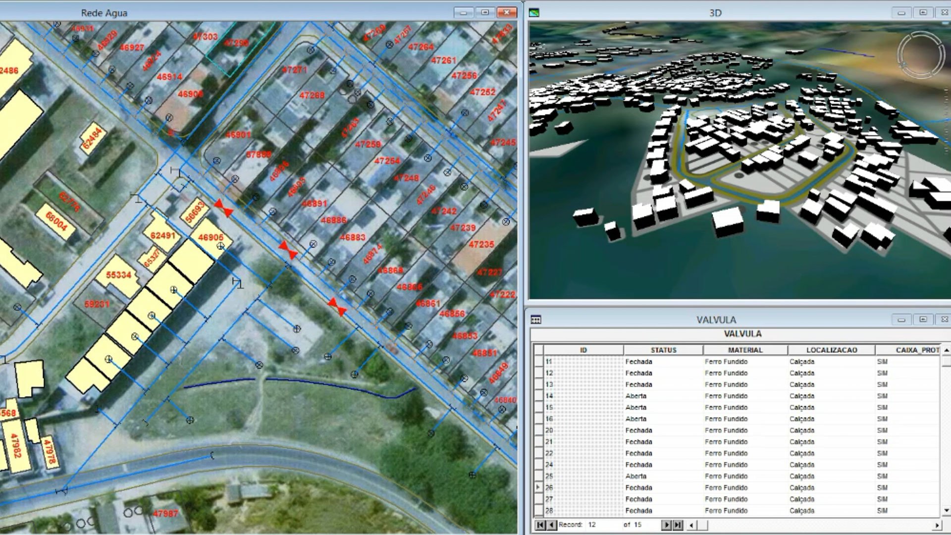
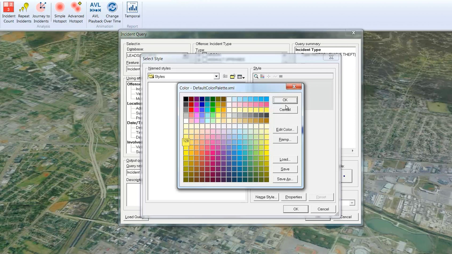
Powerful Spatial Analysis Tools
Perform network modeling, dynamic segmentation, and spatial overlays efficiently. Advanced analysis tools enable users of all skill levels to extract actionable insights from complex geospatial data.
Seamless Data Integration
Support for 300+ data formats including CAD, GIS, and database systems. Integrate information from multiple sources to create a unified view of your spatial data for comprehensive analysis.
Real-Time Data Updates
Dynamically update analyses and visualizations as source data changes. Ensure your results are always current without redoing work, making GeoMedia ideal for time-sensitive applications and operations.

Industry-Standard Interoperability
Adhere to OGC protocols including WMS, WFS, and WCS standards. Share geospatial data effortlessly across systems and collaborate seamlessly with other GIS tools and enterprise platforms.
Customizable Workflows
Tailor user interfaces, workflows, and analysis tools to align with your specific operational needs. Ensure seamless integration into your existing processes for maximum efficiency and productivity.
Client Success Stories
Expert help available
GeoMedia offers first-class customer support to keep your critical business processes running smoothly. Our support desk assists with troubleshooting and advice.
Expand your geospatial capabilities
Discover complementary products that work seamlessly with GeoMedia to enhance your GIS, mapping, and location intelligence capabilities.