Octave IMAGINE
Purpose-built to empower geographic imaging professionals with the tools needed to tackle geospatial data processing.
Integrate essential capabilities into one cohesive solution.
Faster results are on their way
With IMAGINE, remote sensing becomes results. Transform imagery into insight. Move from complex geospatial data to confident decisions, faster and with greater precision. Designed to meet the demands of modern professionals, IMAGINE combines advanced image processing, analysis and visualization tools into one powerful platform.
Expansive analysis and automation capabilities
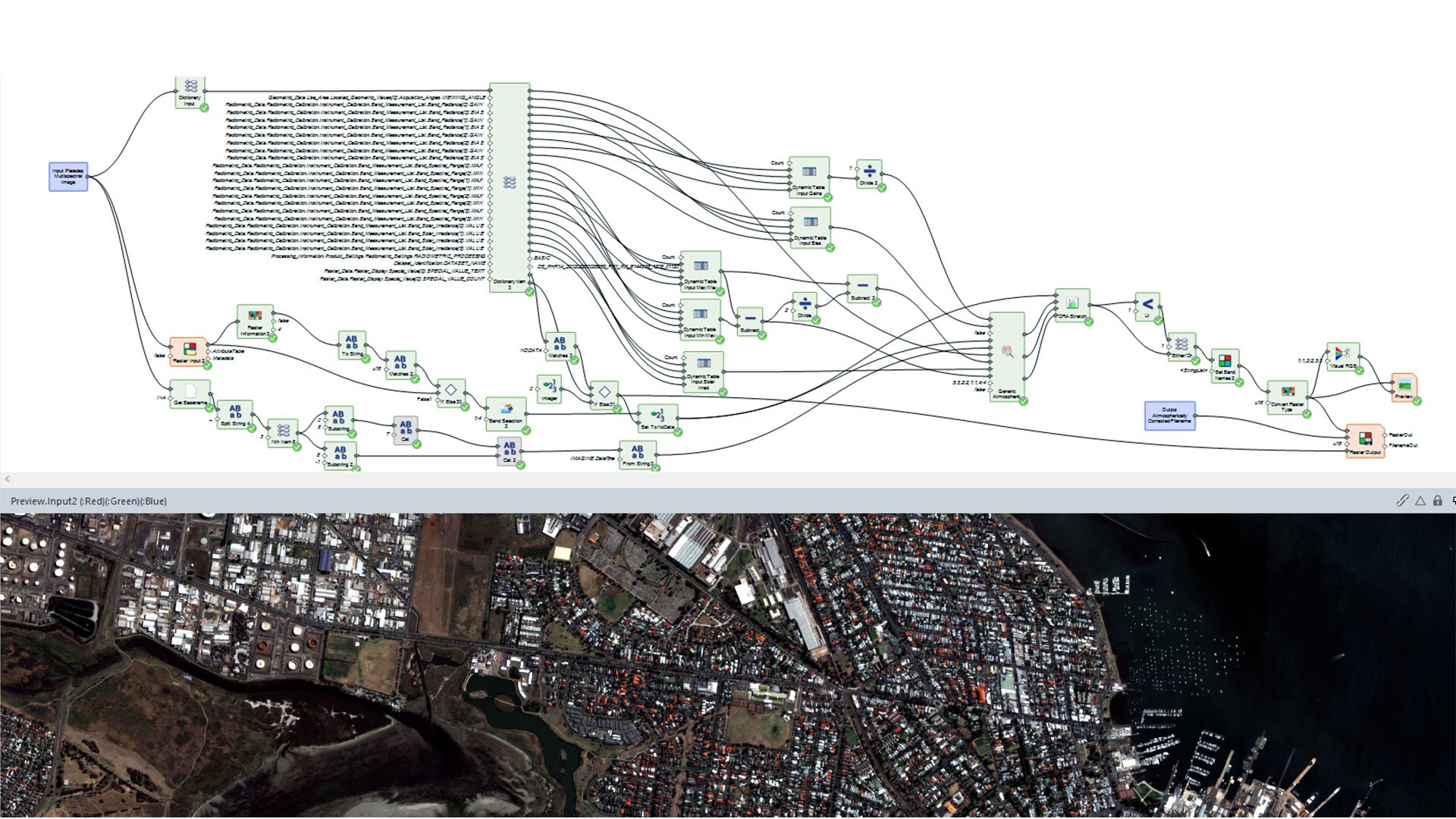
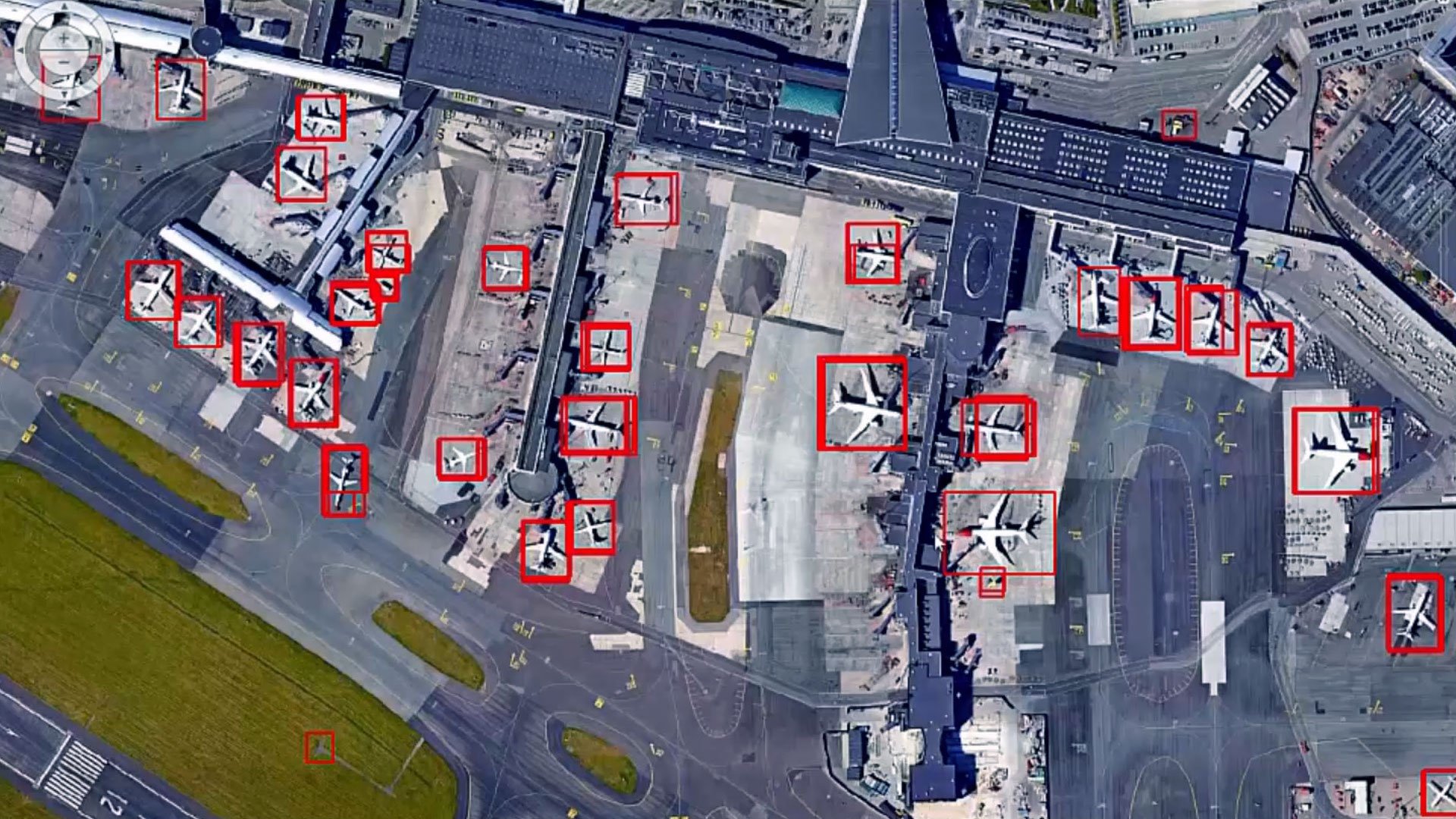
Robust image processing capabilities
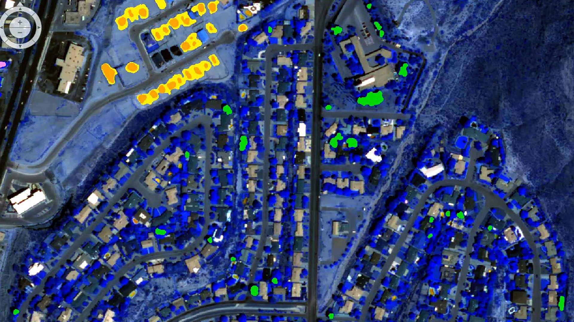
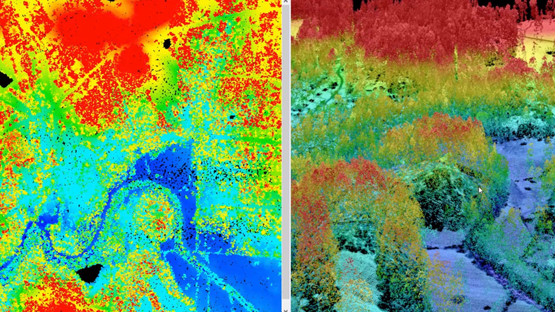
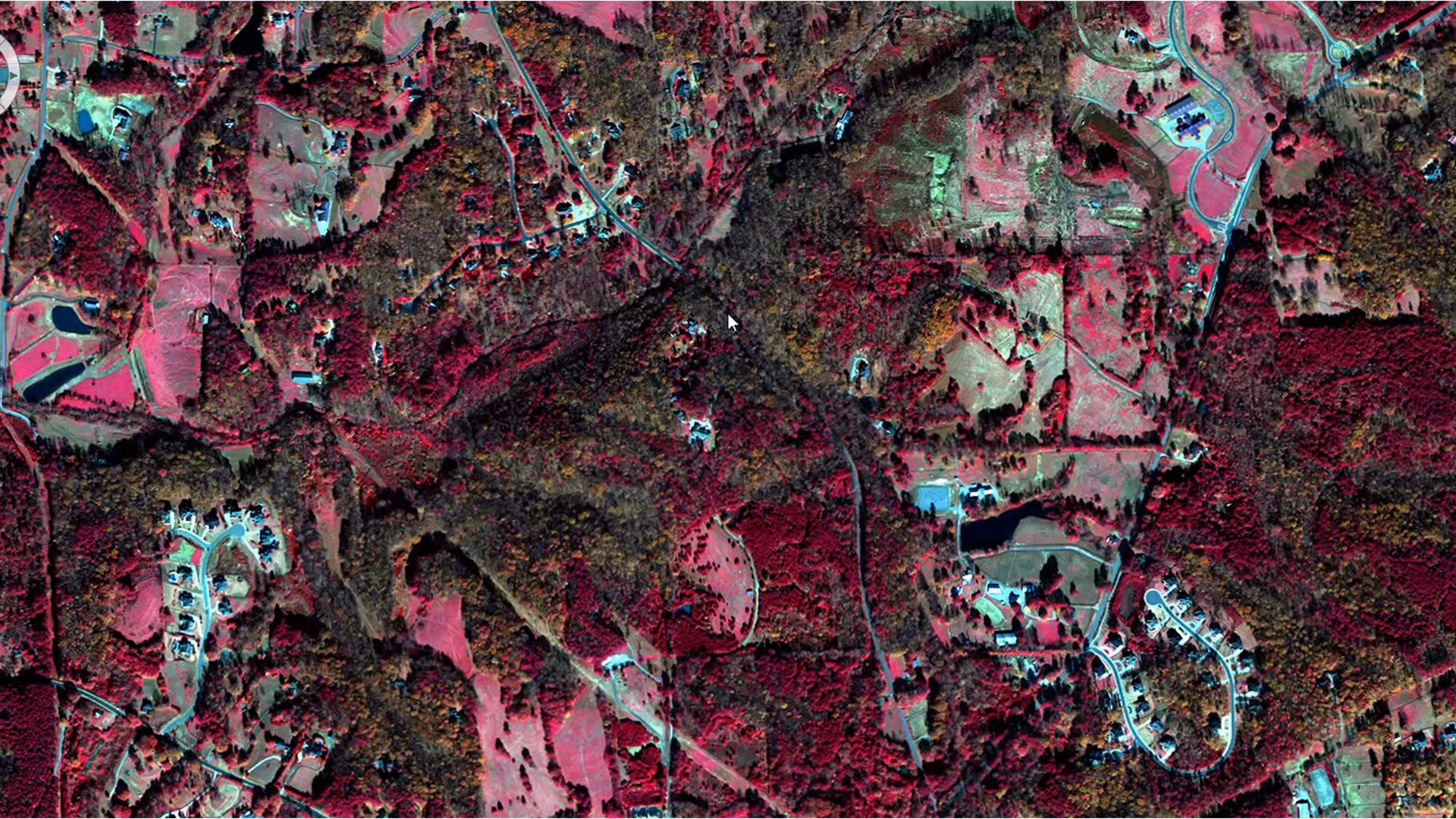
Access a powerful suite of image processing tools, featuring advanced algorithms for image classification, change detection and object-based image analysis.
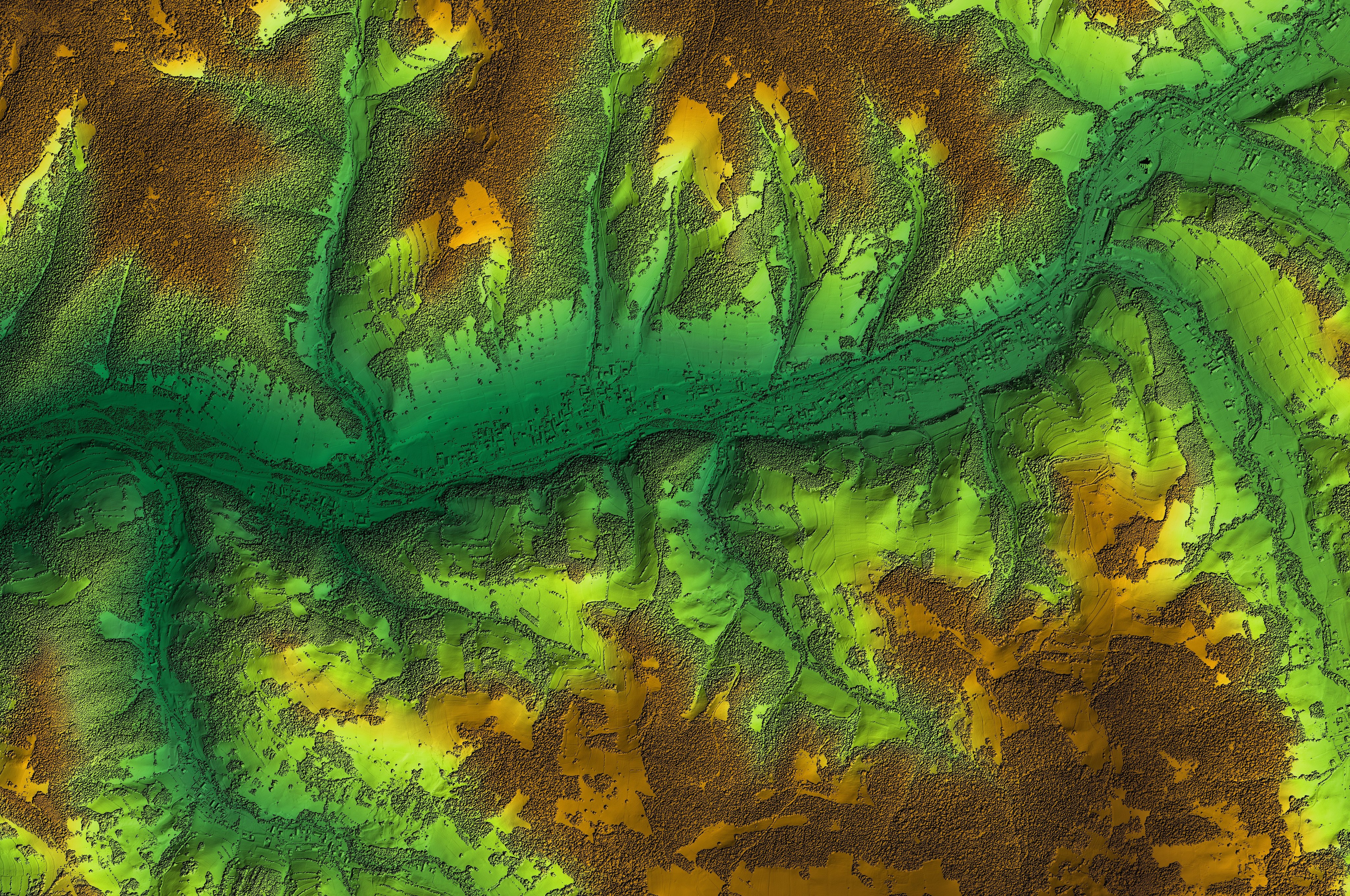
Powerful geospatial analysis
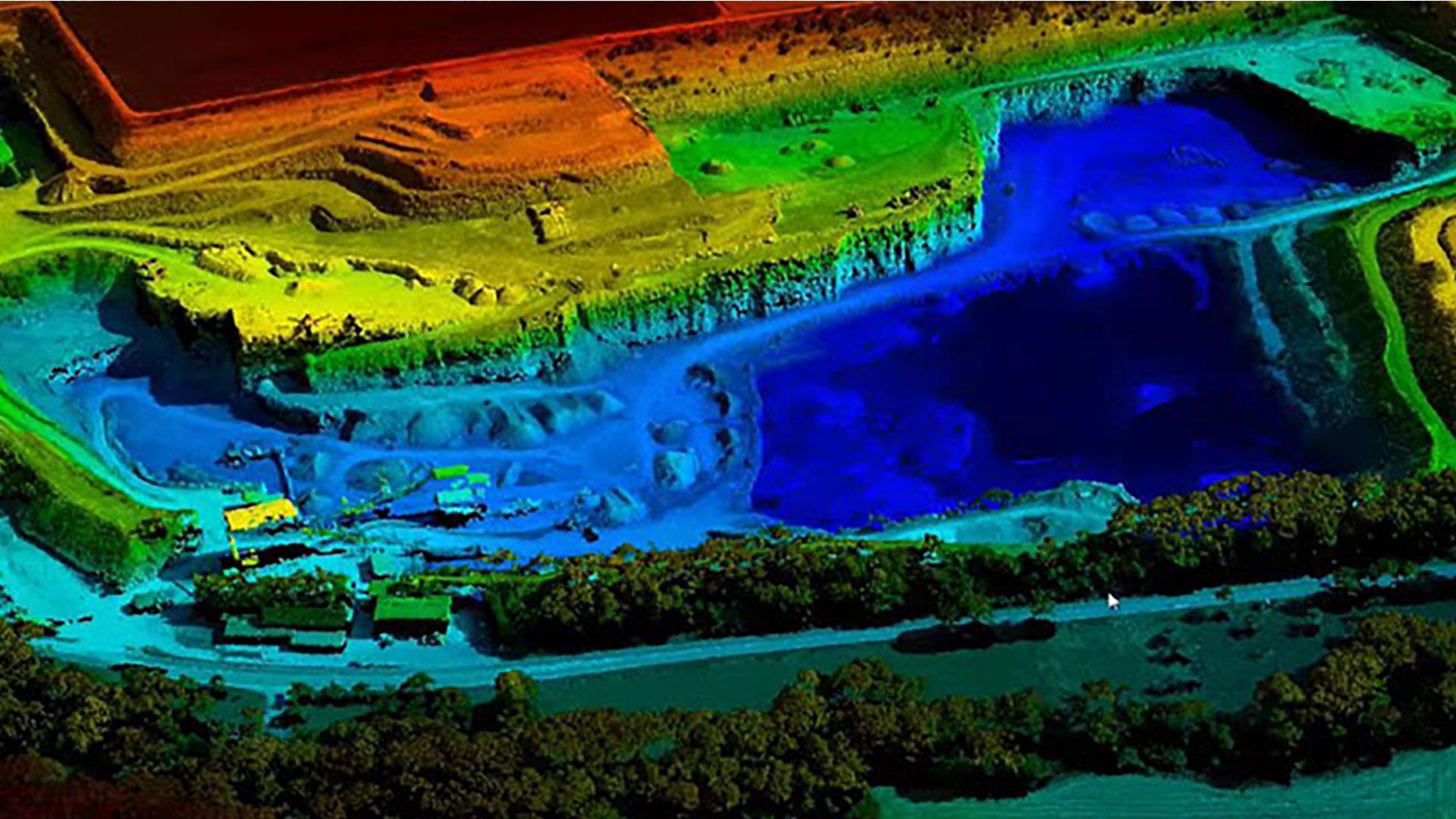
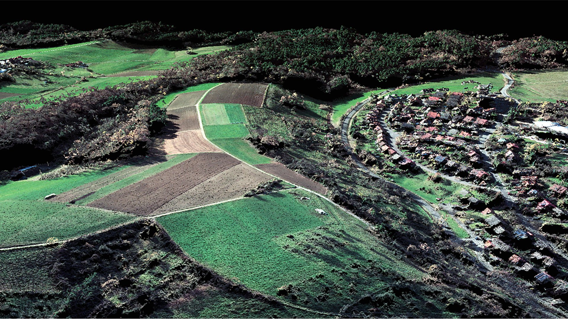
Unlock a versatile set of geospatial analysis tools designed for terrain analysis, surface modeling and immersive 3D visualization.
Efficient workflows
Enhance productivity and save time with the software's intuitive interface and automation capabilities, streamlining your workflows effortlessly.
Extensive support for diverse data formats
Work with a wide variety of data formats, including satellite imagery, aerial photography, LiDAR and more.

Active community and support
Benefit from a robust community of users and Octave's dedicated support team, offering invaluable resources and assistance.

Interoperability with other Octave products
Octave IMAGINE integrates seamlessly with other Octave geospatial products, delivering a comprehensive and efficient geospatial workflow.
Client success stories
Evolve your enterprise

Support when you need
Secure implementation assistance, ongoing product upgrades and technical support anywhere in the world